Dorothy – 12/3/2004
As you travel from Christchurch to Picton you will be rewarded if you allow ample time to enjoy what Kaikoura has to offer – scenery, walks, seals, trips to the whales and adventure sports, but when you have to leave this beautiful little town you will be setting out on a scenic journey along the Kaikoura coast with seascapes on your right and high mountains and bushclad slopes on your left. You can view seals at Ohau Point, picnic on rocky beaches, buy crayfish from roadside stalls, go white water rafting on the Clarence River, take a break at the Kekerengu Restaurant, visit a memorial church, view a combined road/rail bridge at Seddon, and explore the town of Blenheim before travelling the last easy stretch to Picton.
Leaving Kaikoura Travelling north after about 8 km (5 miles) you reach the Hapuku River Bridge and from here on the road follows the coast. You may see surfers in the water at Mangamaunu Beach – a stretch of water recommended only for experienced surfers.
The next area of special note is Ohau Point Seal Colony. On your right there is a parking bay and you can view the seals from the road or walk down the well graded steps for a closer view.
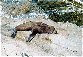 |
| Seal at Ohau Point Photo Source: Peter Hunt Click here to view a larger version |
A short distance further north as the road descends to the coast a signpost clearly indicates the walk to the Ohau Falls.
The road continues along the coast passing through beautiful bays and small settlements where you may be able to treat yourself to the luxury of a crayfish from a roadside stall.
At 40 km (25 miles) from Kaikoura you come to the small settlement of Clarence. The Clarence River runs between the Inland and the Seaward Kaikoura Ranges. Pioneer families developed sheep farms in some very isolated areas in the Clarence Valley.
The settlement at Clarence, like many on the Kaikoura Coast, was originally developed for the building of the railway along the coast. During World War 2 Clarence was the end of the line from Picton and passengers had to travel south from there to Hundalee by service car. With the unsealed and winding road most of the way it was not a comfortable journey.
The road follows the coast for another 35km (22 miles). A long straight stretch has sand dunes on the right and 6 kilometres from Clarence there are three deep dips in the road which our family used to enjoy and call the switchback.
Travelling along this stretch of the road on a clear day you may see the North Island across the water.
At Kekerengu you may wish to take a break for a meal or a tea or coffee at the attractive restaurant, The Store. It has won the Casio Award for the best restaurant in Marlborough.
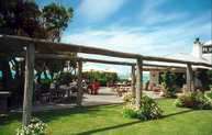 |
| The Store, Kekerengu Photo source: Alister Hunt Click here to view a larger version |
Another reason to pause is Winterhome Garden opposite The Store, and signposted from the main road. The rose gardens are beautiful and from the avocado orchard the view across the Pacific is magnificent.
On the right a little further on is the coloured stone church of St Oswald’s built in 1927 by Mr and Mrs Charles Murray in memory of their son Charles.
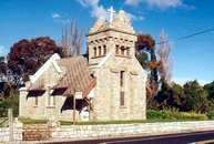 |
| St Oswald’s Church, Wharanui Photo source: Peter Hunt Click here to view a larger version |
Shortly after that the road leaves the coast and the next settlement is Ward, named after the Rt Hon Sir Joseph Ward. a New Zealand Prime Minister twice in the twentieth century – 1906-1911 and 1928-1930. Watch on the main road for two places for a snack or a meal. You can choose between the Flaxbourne Tearooms or the East Coast Inn.
The road runs along the shore of Lake Elterwater where there is a rest area. Soon there is a view of the Grassmere Saltworks where seawater is evaporated from wide shallow ponds.
Watch now for the signpost on the right indicating the road to Marfells Beach at Clifford Bay. This is at present a beautiful, quiet beach but Clifford Bay has been considered as the site for a terminal instead of Picton for the ferry connecting the North and South Islands. That plan is on hold at present.
Seddon is the centre for the Awatere District. Like Ward it is named after Richard John Seddon, a New Zealand Prime Minister from 1893-1906. He and Ward who came after him as Prime Minister are honoured particularly in this area because the large Flaxbourne Estate was divided into small holdings during their premierships.
Until November 2007 to cross the Awatere River you had to wait for the traffic lights to give you entry to the one way bridge which was a combined road-rail bridge first opened to traffic in 1902. The bridge was built by the Christchurch firm, Scott Bros Engineering. A new bridge opened in 2007 to replace this interesting old double decker structure where the railway line was above the road bridge.
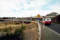 |
| Awatere Bridge Photo source: Alister Hunt Click here to view a larger version |
Watch for the signpost indicating the view of Mount Tapuaenuku – the highest point in the Kaikoura Ranges and an impressive sight on a clear day.
From this point on you will see huge areas of vineyard as Marlborough is one of New Zealand’s biggest wine-producing areas.
On the remaining 25 km (15 mile) stretch to Blenheim you may choose to pause at two historic cottages. The first is Oak Tree cob cottage near Seddon, and the second is the Riverlands Cob Cottage, a pioneer museum beside the main road near Blenheim. Between these you drive over Dashwood Pass and soon after the summit you once again see the sea as you look over Cloudy Bay. Cloudy Bay seems an odd name for the stretch of beach outside Blenheim which has among the country’s highest annual hours of sunshine.
Blenheim Blenheim is an attractively laid out town. For a picnic stop you could go to Pollard Park north of the town centre. It has rhododendrons, rock gardens, rose gardens, and ponds, as well as tennis courts, a croquet green and a golf course.
If you want to eat in a restaurant you can choose to have Kiwi food or to patronise the good quality Chinese food on offer or eat at a restaurant at one of the many wineries, many of which are around Renwick, a small town 10 km (6 miles) west of Blenheim.
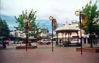 |
| Market Place, the centre of Blenheim’s shopping precinct Photo source: Alister Hunt Click here to view a larger version |
Wine tasting Most visitors to Blenheim choose to visit several of the wineries before leaving the area. On the second weekend in February the annual Marlborough Wine and Food Festival draws thousands of visitors to the town. If you are thinking of attending the festival you will need to book your accommodation early as all beds in Blenheim and the surrounding area are booked well in advance.
Blenheim to Picton Easy travelling takes you to Picton in less than half an hour unless you stop at the rest area beside the memorial to those killed in the Wairau Incident. Misunderstandings between Maori chiefs and some surveyors from Nelson led to a clash here with loss of life.
The town of Picton, the main South Island port linking the South with the North Island, has grown up as a centre catering for those involved in the transport industry, for families farming down the Sounds and for those involved in tourism, both staff and holiday-makers.
It is small enough to be explored on foot and a walk along the foreshore looking out at Queen Charlotte Sound’s sparkling water and bushclad hills provides a pleasant change after hours of travelling.
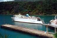 |
| The Interislander near the Picton wharf Photo source: Alister Hunt Click here to view a larger version |

