Dorothy – 18/2/00
An engineering achievement opening up magnificent scenery
The day trip from Te Anau There is limited accommodation at Milford Sound, but there is ample time to make a day trip and visit the Sound and the Observatory.
Some visitors travel to Milford by in their own cars. This gives you the advantage of choosing where and how long you will stop along the way. However many travellers come by bus from Te Anau or even from Queenstown. Designline has designed special vehicles to allow visitors to have the maximum view of the high mountains along the way.
 |
| The Mirage known as the Bullet, specially designed for the Milford trips Photo source Designline |
Whether you travel from Te Anau by car, by bus or by plane the majesty of the mountain scenery makes an impact which is awesome in the true sense of that word. In fine weather the mountain tops are clearer, but in rain the numerous waterfalls are even more impressive.
The journey an experience worth reliving We have made the trip to Milford several times, but each time as we enter the towering mountainous terrain we realise that we had forgotten just how magnificent the country is. With different weather and the changing seasons the views are never just the same.
Every time we travel that road we are impressed by how much it has been improved over the years since our first visit. In the rugged country with its taxing weather the building and the maintenance of the road represent an engineering triumph, but one not achieved without suffering and loss of life in the early years.
The development of the road The route for the road was recommended by W. H. Homer after he and George Barber discovered the Homer Saddle on 27 January 1889. Homer persisted in the suggestion that a tunnel through the saddle would open up the Milford area in spite of opposition from the surveyor whom he took to assess the viability of the idea.
A year later R. W. Holmes, then District Engineer for Wellington, was asked to conduct an investigation and reported that the construction of a tunnel was feasible. He estimated that the cost would be ?000 for a tunnel eight feet high and six feet wide, suitable for horse traffic. In view of the major difficulties encountered in the building of a larger tunnel in the 1930s this was a very optimistic estimate of the cost.
No action on building the tunnel was taken until the depression years from 1929 onward when a number of roading projects were implemented to provide jobs for the unemployed. The work was hard labour as it was all done with shovels and wheel barrows. This method of construction first took the road from the Te Anau township for 30km (19 miles) to reach the Te Anau Downs Station.
The road reached the Divide by 1934. Then the workmen had to face the difficult challenge of building a road down the steep side of the Hollyford Canyon. Blasting and using wheelbarrows and shovels to carry away the debris was heart- and back-breakingly slow.
Tunnel construction begun in 1935 From there to the site of the Homer Tunnel near the head of the Hollyford Valley there was only a pack track, but in the middle of winter – in a climate of snow, ice, torrential rain and avalanches – five men began work on the tunnel – again with only manual labour with picks and shovels.
The engineers had made a decision to take the shortest route for the tunnel with the portal near the left side at the head of the valley. Some local mountaineers had advised that avalanches were frequent in the vicinity of the proposed portal, and had suggested a longer tunnel from a portal a few hundred metres to the right. However this advice was not taken and a shorter tunnel was put through on the left.
The men’s first task was to get through the outer scree to the solid rock to begin blasting. Avalanches during the construction period made the project difficult and over two years caused the deaths of three men and injured others. To prevent a repeat of these disasters an extension was added to the tunnel mouth. The work continued until 1940 when the mountain wall was finally pierced. The length of the tunnel was 1,219 metres (4,000 ft). With all resources and manpower being directed to the war effort work was halted until after the war. Damage occurred once again in 1945 when the air blast of an avalanche from high above acted like an explosive, knocking flat the tunnel extension.
Opening 1954 In 1953 Downer and Company finished the enlarging of the tunnel to 18ft x 24 ft wide (5.5m x 7m), and in 1954 the tunnel was opened to private cars. At that time it was only wide enough to take one way traffic. Now it accommodates two way traffic in comfort.
Take plenty of film with you. The distance from Te Anau to Milford is 121 km (75.5 miles) and the sealed road surface makes for confortable travelling, but you need to allow at least two hours for the journey, as you will want to pause at the viewing areas and take photographs of the mountains and lakes along the way.
After travelling through farmland to Te Anau Downs Station you enter the beech forest, mainly red beech, with a canopy of trees over the road. At about fifty kilometres you enter Fiordland National Park and travel beside the Eglinton River up the Eglinton Valley. Huge mountains tower along the valley sides, some two thousand feet sheer above the valley floor.
The Mirror Lakes as the name implies, give the photographer a great opportunity to take impressive pictures especially when the mountains that they mirror have snow on the tops.
The next stretch of road is known as the Avenue of the Disappearing Mountain. An optical illusion means that the mountain ahead appears to grow smaller as you approach it.
Further on past Knobs Flat the beech forest closes in again and at 76 km (48 miles) you reach Cascade Creek where a camp was set up for the men working on the road construction. A short distance beyond it is the Lake Gunn Nature Walk.
Soon you come to The Divide – the lowest of the passes across the Southern Alps. This point is the start of the Routeburn Track and the Greenstone Track (three day walks to Lake Wakatipu) and the half-day tracks to Key Summit and Lake Howden.
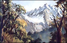 |
| Mt Crosscut from Key Summit – painting by Bill Moore (Click here for a larger version) |
From the Divide the road goes gradually downhill and after a short distance there is a vehicle stop and viewing platform.
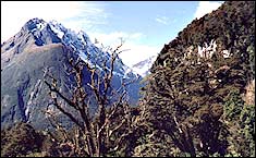 |
| Looking from the viewing platform Click here for a larger version |
From this point on the road runs parallel to the Hollyford River in the Upper Hollyford Valley. Note the turnoff on the right to the Lower Hollyford where are the Hollyford Camp and historical museum.
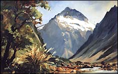 |
| Mt Talbot from the Upper Hollyford – painting by Bill Moore (Click here for a larger version) |
You can see more about Bill Moore and his paintings here
As you approach the Homer Tunnel you cannot fail to notice the impressive peak of Mount Talbot.
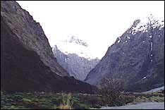 |
| Mt Talbot |
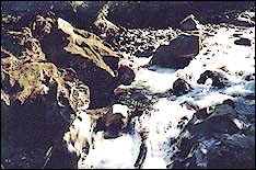
Drive through the Homer tunnel and begin the long descent to Milford Sound, but rather than hurrying to your destination stop at The Chasm where a well paved path takes you to view the Cleddau River which has scoured its way through solid rock.
 |
| The Chasm |
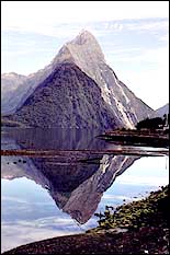
Back on the road you soon reach Milford Sound itself and the familiar view of Mitre Peak.
 |
| Mitre Peak Click here for a larger version |

